Search Term Record
Metadata
Search Term |
Natural disaster |
Number of Object records |
0 |
Number of Photo records |
7 |
Number of Archive records |
0 |
Number of Library records |
0 |
Related Records
-
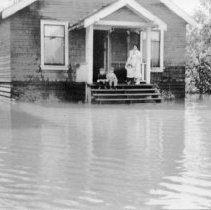
2002.004 - Flooding on Lougheed Highway
Lougheed Hwy flooding looking east Note: Commercial Hotel, Aggie Hall ca.1961
Record Type: Photo
-
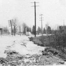
2002.005 - Flood near Shaughnessy
Coquitlam River Flood near Shaughnessy and present day Lions Park
Record Type: Photo
-
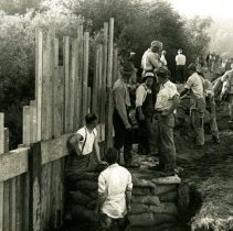
2018.022.2 - Men sandbagging at Colony Farm
A photo of a large group of men by a fence sandbagging and preparing for flooding at Colony Farm in 1948. Taken by R.S. Smith (stamped on the back). "27" is written on the back in pencil.
Record Type: Photo
-
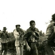
2018.022.3 - Sandbagging at Colony Farm
A photograph of a line of men and young men walking in a line on a path at Colony Farm with towels and sandbags as they prepare for flooding. Taken by R.S. Smith (stamped on the back). "30" is written on the back in pencil.
Record Type: Photo
-
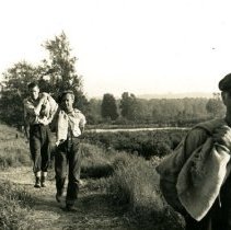
2018.022.6 - Sandbagging at Colony Farm for the 1948 Fraser flood
A photograph of a line of men and young men walking in a line on a path at Colony Farm with sandbags as they prepare for flooding. Taken by R.S. Smith (stamped on the back). "30" is written on the back in pencil.
Record Type: Photo