Search Term Record
Metadata
Search Term |
Roads |
Number of Object records |
0 |
Number of Photo records |
62 |
Number of Archive records |
4 |
Number of Library records |
1 |
Related Records
-
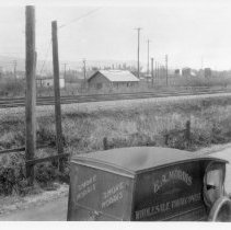
2003.229 - E. A. Morris Tobacconist Truck
E. A. Morris Tobacconist truck drive along road in Port Coquitlam. A CPR building is visibile in the centre of the photograph along with Commercial Hotel in the back left.
Record Type: Photo
-
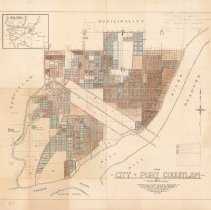
2006.006.78 - Map
Map of the City of Port Coquitlam, B.C. Compiled from official sources by the Clarke & Stuart Co. Limited, 550 Seymour Street Vancouver B.C., July 1920. Multiple pencil annotations; legend in lower right dated April 5th, 1951. Map has been hand-coloured blue, pink, and brown to identify open/closed roads and acreage land.
Record Type: Archive
-
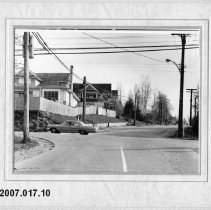
2007.017.10 - Pitt River Road and Schoolhouse
Large black and white photograph depicting the corner of Pitt River Road and Schoolhouse (Mary Hill Road). Housed in a carboard frame.
Record Type: Photo
-
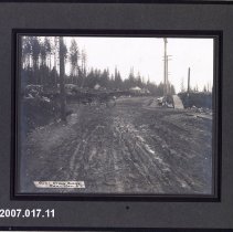
2007.017.11 - Pitt River Road and Schoolhouse
Large black and white photograph depicting the corner of Pitt River Road and Schoolhouse (Mary Hill Road), 1912. A man drives a carriage pulled by a horse. Housed in a cardboard frame.
Record Type: Photo
-
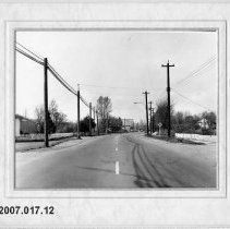
2007.017.12 - Fint Street
Large black and white photograph depicting Flint Street looking towards Lougheed Highway and the Commercial Hotel. Housed in a pale cardboard frame.
Record Type: Photo
-
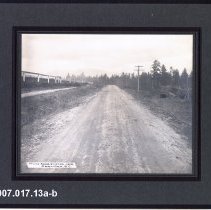
2007.017.13a-b - Trunk Road Finished
Large black and white photographs captioned "Trunk Road Finished, 1909" (referring to Dewdney Trunk Road). Housed in dark cardboard frames. 13a and 13b are duplicates of one another.
Record Type: Photo
-
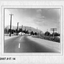
2007.017.14 - Hay Creek Road
Large black and white photograph depicting Hay Creek road, with railway tracks on the right. Housed in a pale cardboard frame.
Record Type: Photo
-
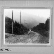
2007.017.3 - North Road and Barnet Highway
Black and white photograph depicting the intersection of North Rd and Barnet Hwy. Man on Motorcyle poses on the road. Housed in a grey cardboard frame.
Record Type: Photo
-
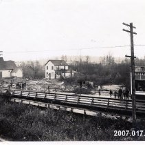
2007.017.39 - Aftermath of second Coquitlam fire
Black and white photograph looking east of a Dewdney Trunk bridge (now Kingsway) after the 1920 fire. Displays some houses, a church, and a wooden bridge. Chinese laundry centre left.
Record Type: Photo
-
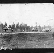
2007.017.59 - Flint Road and Fraser Avenue
large black and white photograph depicting an area of Fraser Ave and Flint Rd. On Front: Poroodleridge 3775 On back: Area of Flint Road and Fraser Avenue, easrly 1920's
Record Type: Photo
-
2007.017.60a - Coquitlam Hotel on Dewdney
Large black and white photographs depicting Dewdney St. On front: Dudney St Cogutlam BC
Record Type: Photo
-
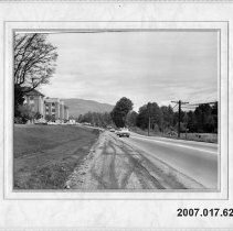
2007.017.62 - Lougheed
Large black and white photograph depicting what is now Lougheed Highway by Riverview Hospital. Written on reverse: Essondale
Record Type: Photo
-
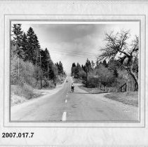
2007.017.7 - Victoria Drive
Black and white photograph depicting Victoria Drive (Victoria Street?) circa the 1950s or 1960s. Housed in a carboard frame.
Record Type: Photo
-
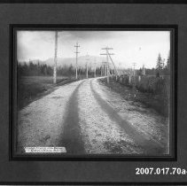
2007.017.70a-c - Finished Road
Large black and white photographs depicting finished road in Port Coquitlam
Record Type: Photo
-
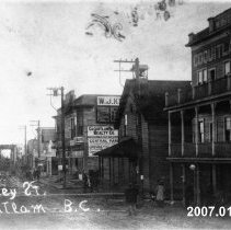
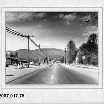
2007.017.76 - Shaughnessy Street looking north
Large black and white photograph depicting Shaughnessy street. Reverse: Shaughnessy Street looking north Kingsway bottom cross street
Record Type: Photo
-
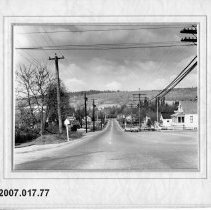
2007.017.77 - Shaughnessy Street
Large black and white photograph depicting Shaughnessy Street. Reverse: Shaughnessy Street west Pitt River Road 1960
Record Type: Photo
-
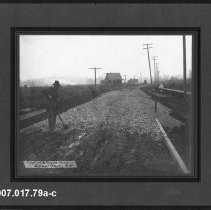
2007.017.79a-c - Constructing Flint Street
Image of road being constructing at the stage of laying gravel/rocks. Man looks towards camera with shovel in hand. Road leads into background. Road lined with telephone poles. A house in the background at TCL. Tape with "First, of three layers rock | Coquitlam, B.C." written is printed onto image at BL
Record Type: Photo
-
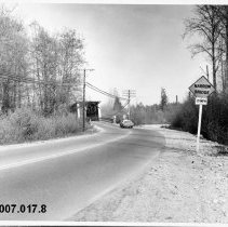
2007.017.8 - The Red Bridge
Black and white photograph depicting the Red Bridge, Port Coquitlam.
Record Type: Photo
-
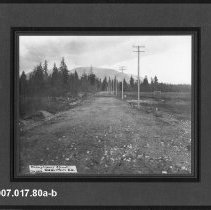
2007.017.80a-b - Shaughnessy St
photograph of a gravel road leading into trees and mountains pictured in background grassy park area (Aggie Grounds) to the right of the road "Shaughnessy St north from railroad tracks" noted on back of print b. Sticker on back of print b notes "Old Aggie GR." (grounds) "Shaughnessy Street, Feb 1912 Coquitlam, B.C" on tape printed at BL
Record Type: Photo
-
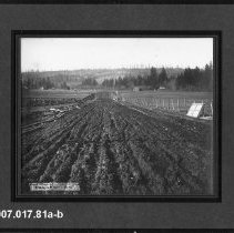
2007.017.81a-b - Road construction, Pitt River Road
Large black and white photographs depicting the first staged of construction with loam on the bottom of the road. 81b Obverse: "Pitt River Road looking towards red Bridge from corner of Shaughnessy St "House on right belonged to Vint "Left background Watts "Circa 1910?
Record Type: Photo