Archives
Enter a word or phrase to perform a general search across all records in the Archives catalog. You can also browse records in the catalog without performing a search.
Search Tips
- Searches are not case sensitive.
- Searching for multiple words connects them with OR by default. Matching records can contain any of the words.
- Connect multiple words with AND if you only want to see records containing both words.
- Use quotation marks to search for a phrase.
- Place an asterisk (*) at the end of a word as a wildcard.
173 results found. Records searched: 173
-
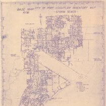
2015.008.7 - Map
Inventory map of Port Coquitlam storm sewers. Base Map R/W. Storm sewer mains are listed in lower left with legend at bottom right of map. Shows storm sewer mains, manholes, dykes, pumpstations, floodboxes, culverts, and catch basins.
Record Type: Archive
-
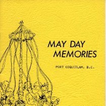
2015.016.15 - Brochure
May Day Memories 1976 brochure Edith Chambers from the files of The Coquilam Women's Institute Archives, photos from the past May Days.
Record Type: Archive
-
-
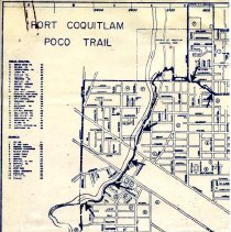
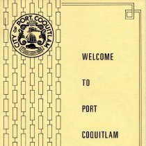
2015.016.7 - Brochure
Welcome to Poco January booklet City of Port Coquitlam Street map Introduction to the History
Record Type: Archive
-
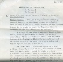
2015.021.1 - Plan
PoCo Urban Renewal project - excerpts from the Eastgate Study 7 pages project proposal including 3 maps. June 1969 City of Port Coquitlam Eastgate Study Urban Programme Planners Ronald E. Mann Planning Consultant. 1065 West 8th Ave., Vancouver 185
Record Type: Archive
-
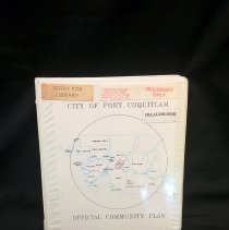
2016.004.12 - Binder, Loose-Leaf
Port Coquitlam Official Community Plan Approved OCP amendment on January 27, 2003 to establish Development Permit Area XVI for crime prevention design guidelines for industrial development. Includes: Revised Record of Amendments Revised Table of Contents Pages 173-182 Map of 1993 Plan Designations
Record Type: Archive
-
2016.004.20 - Map
A lamenated map of the Federal Electoral District of Mission- Coquitlam from 1987. Districts outlined in purple.
Record Type: Archive
-
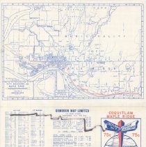
2016.004.21 - Map
A portable map of Coquitlam and Maple Ridge which shows the Port Coquitlam Postal district prior to 1970.
Record Type: Archive
-
-
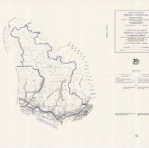
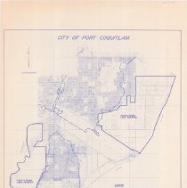
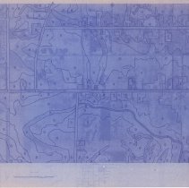
2016.004.34 - Map
City of Port Coquitlam zoning bylaw plan, 1987. No. 2240, Schedule B. Compass and scale bar in upper left, legend in lower right. Dashed lines outline Coquitlam, Pitt, and Fraser River floodplains and agricultural land reserves. Contour Interval 2 metres with gridlines over map.
Record Type: Archive
-
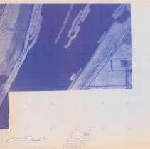
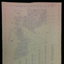
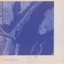
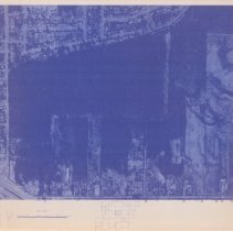
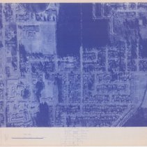
2016.004.40a - Map
A City of Port Coquitlam Photomap compiled photogrammetrically and drawn by Burnett Resource Survey LTD. Date of photography March 23, 1979. Date of map compilation October 1979. Pg. 15.
Record Type: Archive
-
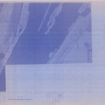
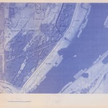
2016.004.40b - Map
A City of Port Coquitlam Photomap compiled photogrammetrically and drawn by Burnett Resource Survey LTD. Date of photography March 23, 1979. Date of map compilation October 1979. Pg. 35.
Record Type: Archive
-
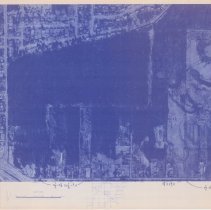
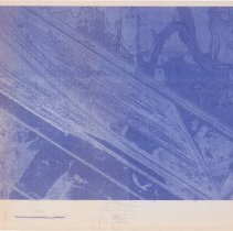
2016.004.40c - Map
A City of Port Coquitlam Photomap compiled photogrammetrically and drawn by Burnett Resource Survey LTD. Date of photography March 23, 1979. Date of map compilation October 1979. Pg. 24.
Record Type: Archive
-
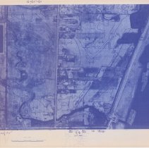
2016.004.40d - Map
A City of Port Coquitlam Photomap compiled photogrammetrically and drawn by Burnett Resource Survey LTD. Date of photography March 23, 1979. Date of map compilation October 1979. Pg. 25.
Record Type: Archive
-
2016.004.40e - Map
A City of Port Coquitlam Photomap compiled photogrammetrically and drawn by Burnett Resource Survey LTD. Date of photography March 23, 1979. Date of map compilation October 1979. Pg. 33.
Record Type: Archive
-
2016.004.40f - Map
A City of Port Coquitlam Photomap compiled photogrammetrically and drawn by Burnett Resource Survey LTD. Date of photography March 23, 1979. Date of map compilation October 1979. Pg. 23.
Record Type: Archive
-
2016.004.40g - Map
A City of Port Coquitlam Photomap compiled photogrammetrically and drawn by Burnett Resource Survey LTD. Date of photography March 23, 1979. Date of map compilation October 1979. Pg. 44.
Record Type: Archive
-
2016.004.40h - Map
A City of Port Coquitlam Photomap compiled photogrammetrically and drawn by Burnett Resource Survey LTD. Date of photography March 23, 1979. Date of map compilation October 1979. Pg. 43.
Record Type: Archive
-
2016.004.40i - Map
A City of Port Coquitlam Photomap compiled photogrammetrically and drawn by Burnett Resource Survey LTD. Date of photography March 23, 1979. Date of map compilation October 1979. Pg. 34.
Record Type: Archive
-
2016.004.40j - Map
A City of Port Coquitlam Photomap compiled photogrammetrically and drawn by Burnett Resource Survey LTD. Date of photography March 23, 1979. Date of map compilation October 1979. Pg. 25.
Record Type: Archive