
Archive Record
Images
Metadata
Catalog Number |
2016.004.34 |
Object Name |
Map |
Description |
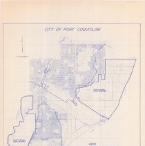
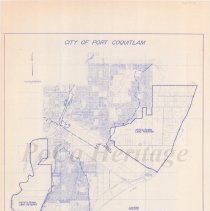
City of Port Coquitlam zoning bylaw plan, 1987. No. 2240, Schedule B. Compass and scale bar in upper left, legend in lower right. Dashed lines outline Coquitlam, Pitt, and Fraser River floodplains and agricultural land reserves. Contour Interval 2 metres with gridlines over map. |
Title |
City of Port Coquitlam Zoning Bylaw Plan |
Date |
1987 |
Condition |
Good |
Search Terms |
Map Maps Port Coquitlam By-laws Zoning Agriculture |