Search Term Record
Metadata
Search Term |
Maps |
Number of Object records |
0 |
Number of Photo records |
2 |
Number of Archive records |
83 |
Number of Library records |
9 |
Related Records
-
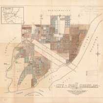
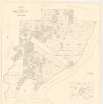
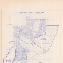
2006.006.77 - Map
Map of the City of Port Coquitlam, B.C. Compiled from official sources by the Clarke & Stuart Co. Limited, 550 Seymour Street Vancouver B.C., July 1920. Blocks 255, 288, and 231 in lower right have been hand-coloured to reflect 5-part legend. Some pencil annotations. Watermarked with a "Beaver & Bond" logo.
Record Type: Archive

-
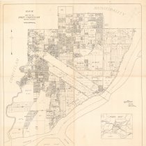
2006.006.78 - Map
Map of the City of Port Coquitlam, B.C. Compiled from official sources by the Clarke & Stuart Co. Limited, 550 Seymour Street Vancouver B.C., July 1920. Multiple pencil annotations; legend in lower right dated April 5th, 1951. Map has been hand-coloured blue, pink, and brown to identify open/closed roads and acreage land.
Record Type: Archive
-
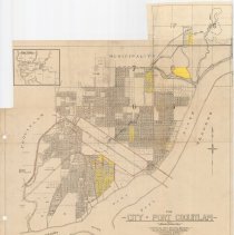
2006.006.79 - Map
Map of the City of Port Coquitlam, B.C. Compiled from official sources by the Clarke & Stuart Co. Limited, 550 Seymour Street Vancouver B.C., July 1920. Areas have been highlighted in yellow, select roads coloured brown. Multiple pencil annotations including James Park School in upper left. Watermarked with a "Beaver & Bond" logo. Top edge has been cut irregularly.
Record Type: Archive
-
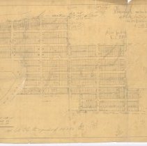
2006.006.82 - Plan
Hand-drawn map of a proposed subdivision of the North Westerly portion of D.L. 174, and of 29 acres on Pitt River Road. Multipe pencil annotations and equations.
Record Type: Archive
-
2006.006.83 - Map
Map of Port Coquitlam. Title and scale in upper left, index map of surrounding municipalities in lower right. Compiled from land registry office records.
Record Type: Archive
-
2011.014.3 - Map
Map of Port Coquitlam. Title and scale bar in upper left, index map of surrounding municipalities in lower right. Compiled from Land Registry Office records. Original map date May 14, 1952. Revised July 1963. Pencil markings in upper right corner.
Record Type: Archive
-
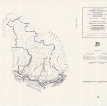
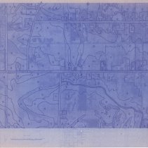
2015.008.3 - Map
Map of fish-bearing and non-fish-bearing waterways in Port Coquitlam, to be used as a guide for determining the classification of stream habitats. Map is annotated in red, blue, and yellow. Text in lower left, legend in lower right.
Record Type: Archive
-
2015.008.4 - Map
Map of Port Coquitlam. Parks are outlined in green and schools in red. Garbage cans are indicated by red dots.
Record Type: Archive
-
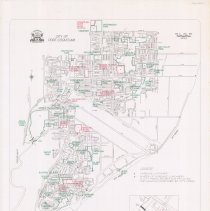
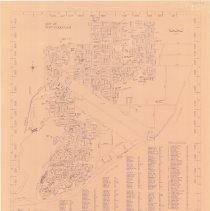
2015.008.6 - Map
Map of Port Coquitlam . Blue print on dark beige paper. Title in upper left, scale bar in upper right. Roads, public facilities, and schools are listed across bottom of map.
Record Type: Archive
-
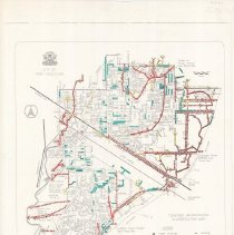
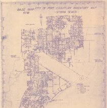
2015.008.7 - Map
Inventory map of Port Coquitlam storm sewers. Base Map R/W. Storm sewer mains are listed in lower left with legend at bottom right of map. Shows storm sewer mains, manholes, dykes, pumpstations, floodboxes, culverts, and catch basins.
Record Type: Archive
-
2016.004.20 - Map
A lamenated map of the Federal Electoral District of Mission- Coquitlam from 1987. Districts outlined in purple.
Record Type: Archive
-
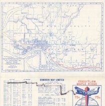
2016.004.21 - Map
A portable map of Coquitlam and Maple Ridge which shows the Port Coquitlam Postal district prior to 1970.
Record Type: Archive
-
2016.004.34 - Map
City of Port Coquitlam zoning bylaw plan, 1987. No. 2240, Schedule B. Compass and scale bar in upper left, legend in lower right. Dashed lines outline Coquitlam, Pitt, and Fraser River floodplains and agricultural land reserves. Contour Interval 2 metres with gridlines over map.
Record Type: Archive
-
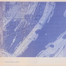
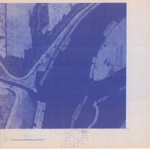
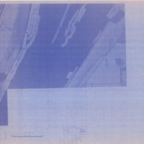
2016.004.40a - Map
A City of Port Coquitlam Photomap compiled photogrammetrically and drawn by Burnett Resource Survey LTD. Date of photography March 23, 1979. Date of map compilation October 1979. Pg. 15.
Record Type: Archive
-
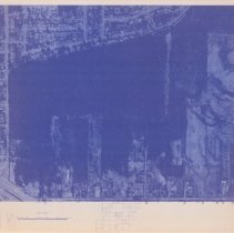
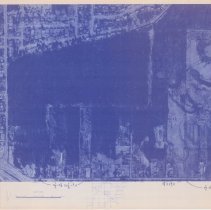
2016.004.40b - Map
A City of Port Coquitlam Photomap compiled photogrammetrically and drawn by Burnett Resource Survey LTD. Date of photography March 23, 1979. Date of map compilation October 1979. Pg. 35.
Record Type: Archive
-
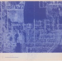
2016.004.40c - Map
A City of Port Coquitlam Photomap compiled photogrammetrically and drawn by Burnett Resource Survey LTD. Date of photography March 23, 1979. Date of map compilation October 1979. Pg. 24.
Record Type: Archive
-
2016.004.40d - Map
A City of Port Coquitlam Photomap compiled photogrammetrically and drawn by Burnett Resource Survey LTD. Date of photography March 23, 1979. Date of map compilation October 1979. Pg. 25.
Record Type: Archive
-
2016.004.40e - Map
A City of Port Coquitlam Photomap compiled photogrammetrically and drawn by Burnett Resource Survey LTD. Date of photography March 23, 1979. Date of map compilation October 1979. Pg. 33.
Record Type: Archive
-
2016.004.40f - Map
A City of Port Coquitlam Photomap compiled photogrammetrically and drawn by Burnett Resource Survey LTD. Date of photography March 23, 1979. Date of map compilation October 1979. Pg. 23.
Record Type: Archive
-
2016.004.40g - Map
A City of Port Coquitlam Photomap compiled photogrammetrically and drawn by Burnett Resource Survey LTD. Date of photography March 23, 1979. Date of map compilation October 1979. Pg. 44.
Record Type: Archive